Lifecanbetoff
When it comes to dog friendly adventures, Fan Gyhirych from Penwyllt in Brecon Beacons (Bannau Brycheiniog) scores high on our list. There are multiple routes to choose here, but we opted for the (almost) 7 mile out and back from Penwyllt.
This centrally located mountain gifts you amazing 360 degree views including Fan Brycheiniog and Llyn y Fan Fawr, Cray Reservoir, Fan Hir and Pen y Fan. On a truly good day, you could probably see right to the ocean.

Quick facts
Height: 725m marked by a trig point, located on the western side
Area: Fforest Fawr section of the Beacons and sits within the boundary of Powys.
AllTrails route: Fan Gyhirych from Penwyllt
Parking: Free and plentiful at the Penwyllt stone quarry (near to South Wales Caving Club) This is your starting point.
Toilets: None
Time: We did this in just under 4 hours. This was with plenty of breaks and a stop for snacks and a brew with a view!
Distance: 10.5km
Difficulty: Moderate but the route is incredibly easy to follow
Dogs: There is livestock so on lead.
Footwear: Sturdy boots for uneven paths, once off “road” there are areas which could be boggy in wet weather.
Fan Gyhirych from Penwyllt
Starting from the Penwyllt stone quarry car park, walk in the direction of the caving club and turn left through a gateway. This leads you up a very distinct footpath along the Beacons Way Path.
Begin the gradual ascent and after approximately half a kilometre turn left to join the Cambrian Way. This path follows the old tram road track which you follow as it gradually climbs the hillside.
You’ll eventually come across a gate with information board and the views begin to open up. Here there are remnants of buildings and brick works.
Here you’ll see Fan Hir, this is the site of the Vampire VZ106 crash site
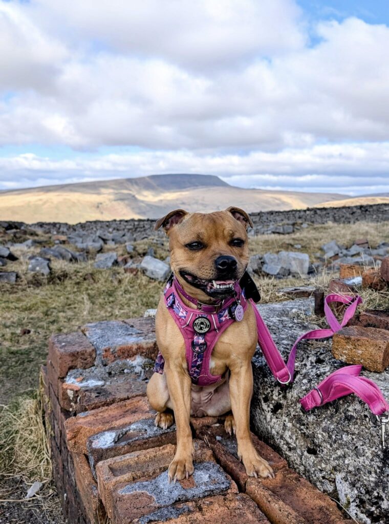
From here, the path begins to flatten out, forestry opens out in the valley to your left as you continue to follow the distinct tram track. Be mindful of metal studs sticking out of the ground! After around 1.7km branch left off the tram road and join a stone track. Follow this track as it climbs towards the summit.
The incline of this stone track seemed to go on for quite a while, crossing a cattle grid (there is a stile to the left hand side to climb over) and we found we took plenty of stops on the ascent.
Upon reaching the 660m contour veer left off the stone track and join a barely distinct footpath heading directly up a grassy slope. We did miss the turn here, and only realised after I checked the AllTrails route, we backtracked slightly and rejoined the route itself.
This grassy footpath (boggy in places) leads directly to the summit trig point around half a kilometer away.
Upon reaching the trig point, get the obligatory trig point shot (there was a boggy moat surrounding it which Toffee loved!) and walk beyond to enjoy views down the valley towards Crai Reservoir.
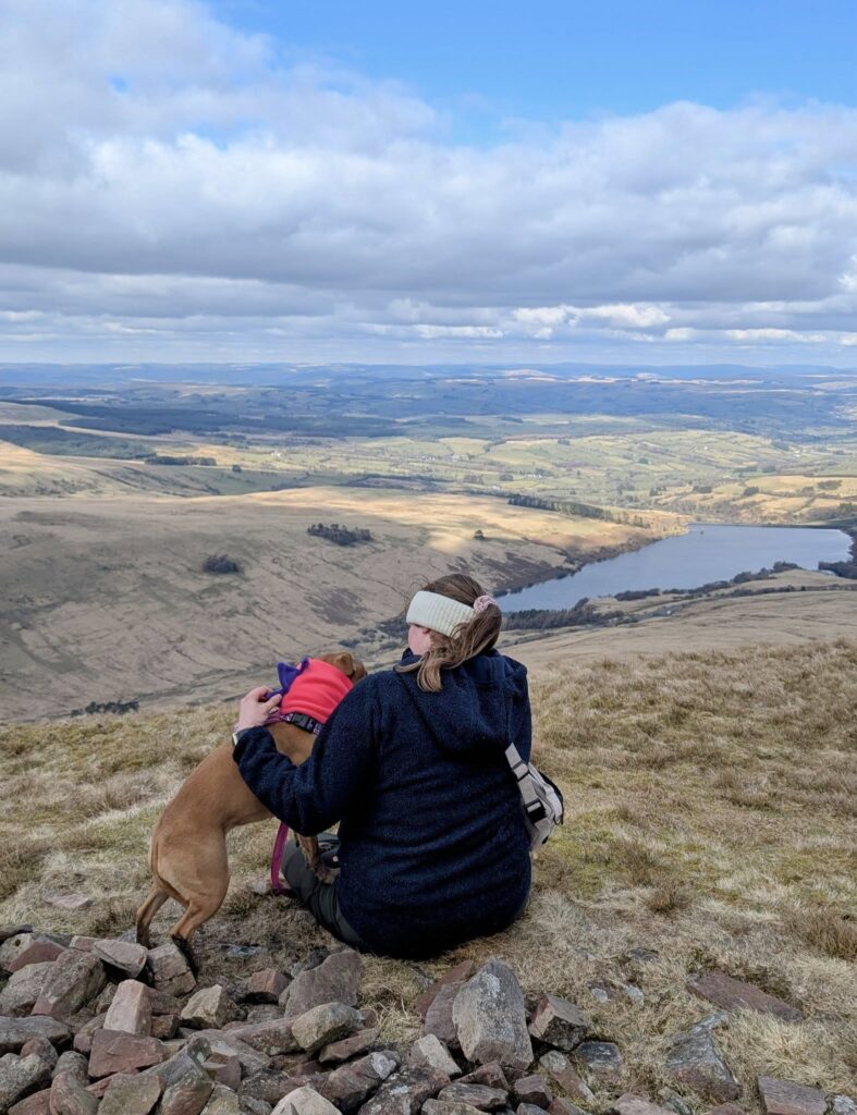
Once you have managed to tear yourself away from the view, retrace your footsteps back to the starting point. You’ll get to enjoy the views all over again through fresh eyes.
Stop for snacks, enjoy a brew with a view, and just take it all in.

The Life can be Toff dog friendly adventures paw rating
The only thing that let this route down was the track being long. I was concerned for Toffee’s paw pads and it was a killer on the ankles!
I wouldn’t usually choose an out and back route as I tend to find them a bit boring, but the views here were so incredible, seeing it on the way back provided you with a whole new perspective with which to see those incredible views in ALL directions.
We enjoyed a peaceful walk on what was an incredibly beautiful Saturday morning. Arriving at about 10.30am to a quiet car park, the route itself was equally as quiet, with there being more people as you get closer back to the car park.
Whilst we kept Toffee on her shorter lead, she could have gone on her longline, but some comments about sink holes in the AllTrails routes did put a little concern in my mind so wanted to keep her close. There were some water courses along the route including a stream, but would advise taking enough water for all and snacks for everyone! There is livestock roaming so please be mindful of this and keep dogs under control.
We ate our lunch back in the car, but there are plenty of spots to stop and eat, especially on a good day. It seemed a shame to come down so soon, but home eventually calls!
We will definitely go back.
Hiking Fan Gyhirych – what will you need?
- Plenty of water
- Flask of tea – we used our Syd and Co Paws Outdoors flask and mug set. Code Toffee10 gets you money off.
- Snacks and lunch
- Layers, hats and gloves – it is an exposed hillside so can get chilly
- Waterproofs – we checked the weather before hand and there was sleet forecast, but we didn’t need the waterproofs.
- Good hiking boots – it was dry enough for walking shoes, but it can be boggy in wet weather. There is a lot of uneven paths where ankle support was greatly appreciated!
- Dog water bowl
- Dog snacks
- Spare lead
- GPS pet tracker – we have a PAJ pet GPS (gifted).
- Spare coat for at the summit or snood (depending how cold your dog gets)
- First aid kit (we have a small dog friendly version we’ve put together too).
- A downloaded route – there was signal but it was sketchy in parts. Be prepared if you’re going off the beaten path.
We give this 4/5 paws 🐾
Peace out!
Jangles x
Check out my dog walking essentials for some of my general dog walk favourites. I definitely need to get a hiking one together!
This post contains gifted items or links to items where we are a brand ambassador. We receive a discount as a rep, but you get a discount too.